Climate modeling tailored to your project
Questions? Let's get in touch.


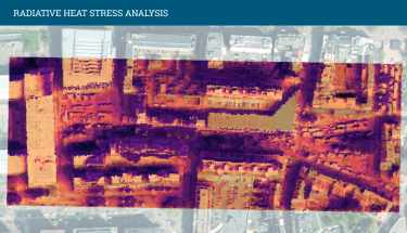
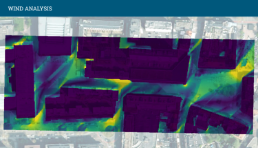
Making informed decisions on heat, wind, and quality of life
European, national, and regional policies increasingly push for climate action. At the same time, the demand for project‑specific, detailed insights is growing: How strongly is the local environment already experiencing the effects of climate change? How will this evolve? And what can we do about it? With our climate modeling, we provide clear, actionable answers. We map spatial differences in heat and wind, highlight risks (heat stress, wind hazards), and reveal opportunities to make designs climate‑adaptive and resilient.